
Rushy Mead Map Ref: TL 497197
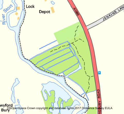 Public Transport: – 800m walk from Bishops Stortford station (BR Liverpool St – Cambridge); head south along the River Stort towpath. Hourly bus service (No 5) from Bishops Stortford station passes the reserve entrance on the A1060.
Dogs allowed if under effective control. Please clean up after your dog.
Access: – Accessible at all times but paths unsurfaced and rough.
Directions:
One mile south of Bishops Stortford, lying between the A1060 road to Hatfield Heath and the River Stort. It can be entered from the A1060 or from the towpath running alongside the Stort Navigation. No car park on site, park carefully on the road verge opposite.
What to look for:
The name of the reserve comes from an old tithe map showing the site as riverside meadows. In the earlier part of the twentieth century it was used in connection with the local sewage works with settling beds on the low ground close to the Stort Navigation. This use ceased in the 1950s and the site reverted to nature, developing areas of sedge and reed, whose tall, dense growth provides cover for birds in summer, and winter. There is no access to these areas due to the very wet soil conditions, and deep drainage channels. The northern end of the site has developed into mature Alder and Willow woodland, though in recent years the Willows have been colonised by fungi which are slowly killing them. It is a particularly good area for birds including Woodpeckers, and large flocks of Siskin feeding in the mature Alders in the winter months.
Yellow Iris and Wild Angelica are just two of the many plants that flower here in summer. The ditches provide an ideal habitat for a range of wildlife including Marsh Marigold, dragonflies and water beetles.
The drier ground has areas of scrubby woodland and chalky grassland close to the road. The latter supports a good variety of wild flowers including Wild Carrot and Chalk Knapweed.
The reserve is managed by an autumn cut of the grasslands to maintain diversity.